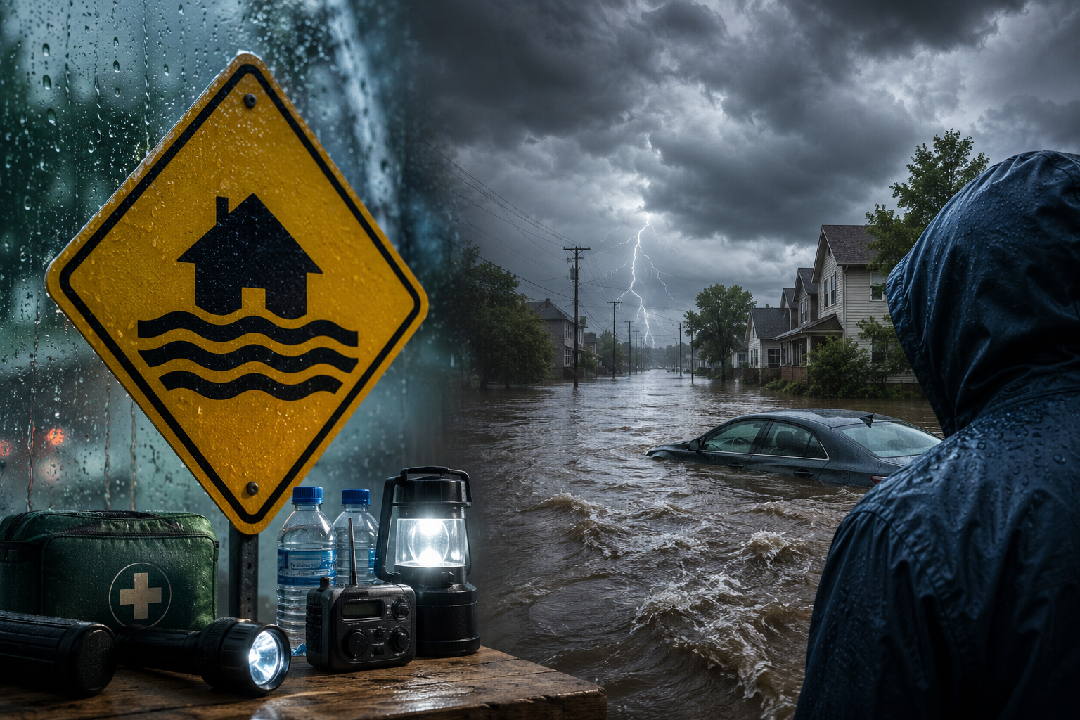
Rain is falling harder. A creek nearby is rising fast. Your phone buzzes with an alert: flood watch.
Everyone just takes a quick look before continuing to scroll down. This is not the right thing to do. It could make the difference between being able to spend the night safe and sound at home or spending the night stranded in flood-hit streets.
What is a flood watch, and why does it matter?
A flood watch is an official alert from the National Weather Service (NWS). It means your area has the right conditions for flooding to develop. Roads aren’t necessarily flooding yet, but they could, and soon.
According to the NWS, a flood warning is issued when slow-moving storms, wet soil, or high rainfall amounts lead to imminent flooding in the upcoming 12 to 48 hours. This is a warning that should not be taken lightly.
Middle Tennessee received such a warning on June 7, 2026, from 6 a.m. to 8 p.m., as rain amounts between 1 and 3 inches were expected, while some areas would receive more than 4 inches. Repeated rounds of slow-moving showers and thunderstorms were expected from daybreak through evening, exactly the kind of setup that turns streets into rivers.
Slow storms are more dangerous than fast ones. The ground gets soaked before it can drain. Water pools. It rises. And by the time it looks bad, it’s already bad.
Types of flood watches you need to know
The NWS issues different types based on where the flooding risk comes from. Each one tells you something specific.
Flash flood watch
This means fast, sudden flooding is possible, usually within six hours of heavy rain. Flash floods can happen very fast, usually with little prior warning.
With respect to the flash flood of June 2026 in Middle Tennessee, forecasters warned that there was a possibility of flash floods in one location, without knowing exactly which one. This is because there was a chance that you would be taken by surprise.
Flash floods account for more deaths than any other kind of natural disaster in America annually, more than hurricanes. Not tornadoes. Floods.
Areal flood watch
This refers to an extensive area where the occurrence of prolonged rainfall leads to flooding due to hours or days of continuous precipitation. River and stream levels slowly swell to exceed normal levels.
In aerial floods, water moves slowly from one point to another as a result of multiple-day rainfall, which leads to flooding because the water cannot flow fast enough downstream.
Coastal flood watch
This happens near oceans, bays, and tidal rivers. This occurs when the potential for storm surge, high winds blowing inland, or tidal conditions cause a threat of moving water into the area. The most frequent warning is issued due to hurricane storm surge. This may occur with even a minor storm if the wind moves water directly inland.
Lakeshore flood watch
These apply to areas surrounding large bodies of inland waters such as the Great Lakes region. The strong wind pushes the lake waters towards the shores, resulting in higher-than-normal water levels. This could lead to flooding of buildings and streets close to the coast without any rainfall in the vicinity.
These warnings are most often issued in the fall and winter season due to strong winds caused by cold fronts.
Flood watch vs. warning: the real difference
These two get mixed up each and every time there is bad weather. This leads to loss of many lives.
This is an indication that the possibility of flooding exists. There is potential for floods.
This indicates that flooding has occurred or will occur very soon. Don’t wait.
A flood advisory means minor flooding is occurring or expected, a nuisance rather than a danger for most people, but still worth tracking.
Think of it this way: a watch is weather giving you time. A warning is weather telling you you’ve run out of it.
When a watch upgrades to a warning, your plan should already be in place. That’s the whole point of a watch; it gives you the window.
The June 2026 Middle Tennessee watch ran 14 hours. Predictors indicated that the area west of Interstate 65 was the primary concern, and it is here where rainfall amounts would be at their greatest. Streams and creeks would continue rising throughout the day.
What a flood watch means for you right now
When one is issued for your county, the response isn’t panic; it’s preparation. Here’s what that looks like.
Check your surroundings. Do you live near a creek, a low-lying road, or a spot that’s flooded before? Those places flood first, every time. Know them.
Move things up. Valuables, documents, electronics in a basement or on a ground floor, move them higher. Takes ten minutes.
Charge your devices. Power outages follow heavy storms. A dead phone during flooding is a genuine problem.
Fill your car’s gas tank. Stations close or lose power after major weather events. Don’t get caught short.
Know your routes. Before you drive anywhere, check which roads stay above water and which ones flood. Local traffic maps help. Your instincts about roads you’ve driven a hundred times may not.
The one rule that saves more lives than any other: never drive through flooded roads. Six inches of water can knock a person off their feet. Twelve inches can carry a small car. Two feet of moving water can take nearly any vehicle. People die every year because water looked shallow enough. It wasn’t.
NOAA reports that more than half of all flood-related drownings happen inside vehicles. Turn around.
NYC flood watch and the urban flooding problem
Cities face a different kind of flood danger. New York City showed the world this clearly when storms dropped several inches of rain in just a few hours, subway stations filled with water, cars stalled on highways, basement apartments flooded within minutes.
A flood watch in NYC carries particular weight because the city’s drainage system was built for much lighter rain. When storms slow down and intensify, which is happening more often, the infrastructure can’t keep pace.
Urban areas have high impervious cover: concrete, asphalt, and buildings across most of the ground. Rain can’t soak in. It runs off instantly into drains that overflow fast.
This is the reason behind a watch being more hazardous in an urban setting than a rural one that has open spaces to spare. Where would the water flow other than on streets, underpasses, and buildings?
If you happen to live in or around a big city, be sure to heed such warnings. Basement flooding occurs far quicker than most anticipate, while evacuation of a flooded stairwell poses its own challenges.
How to find flood watch information near you
weather.gov, The NWS website shows all active watches, warnings, and advisories for every county in the US. Enter your city or zip code to see what’s in effect right now.
Wireless Emergency Alerts (WEA): These are the loud alerts that buzz your phone even when it’s on silent. They go out automatically to all phones in an affected area. Check your phone’s settings to confirm emergency alerts are turned on.
Local weather apps, Most pull NWS data and display active watches on a map. Worth checking every morning during storm season.
NOAA Weather Radio: A dedicated radio that picks up NWS alerts around the clock, no internet or cell service needed. Worth having in areas that lose power regularly.
Local TV and radio, during active weather events, local stations provide real-time updates that apps can’t match for speed or local detail.
The single most important step: make sure you’re receiving alerts before a storm starts. Not while you’re watching the water rise.
What happens when people ignore flood warnings
Flooding kills an average of 95 Americans per year, according to NOAA’s flood loss data, more than tornadoes, hurricanes, or lightning on their own. About 75% of those deaths happen in vehicles.
The “Turn Around, Don’t Drown” campaign exists because the message needs to be that direct. Flooded roads look passable. They rarely are. The presence of water masks road damage, washouts, and drop-offs that motorists cannot recognize until it is too late.
The financial toll of flood damage in the USA stands at about $8 billion per year, according to estimates by NOAA. This does not include displacement, personal loss, or the time invested in recovery from one event.
The June 2026 Middle Tennessee watch wasn’t routine. Forecasters designated it a First Alert Weather Day, a label used when conditions have real potential to cause harm.A series of storms would occur, and the afternoon and evening would be most at risk for flooding.
This kind of thing doesn’t happen that much anymore. Warm air can hold more water. It is raining more intensely within a smaller window of time. Understanding what it means to be under a flood watch is more important now than ever before.
What to do before, during, and after a flood watch
Before a watch becomes a warning
Register for emergency alerts in your area via the county emergency management website. Find out what you know about your home’s flooding history and look at FEMA flood maps by going to msc.fema.gov. Store essential papers in a plastic bag located upstairs. Remember to locate the water shut-off valve as contaminated water from floods may get into your home’s supply.
During a watch or warning
Stay off roads, especially those near creeks and rivers. Avoid walking through moving water; six inches can knock an adult down. Get to the highest level of your house should water start entering. Avoid touching any electrical appliances if you are wet or standing in water. Prevent your children and pets from being near any drains, ditches, or streams.
After flooding recedes
Don’t return home until authorities clear it. Document everything before touching anything, as this is important to your insurance claim. Use boots and rubber gloves during cleanup efforts because flood water has waste and germs. Check for damage to the structure of the home around the base before you enter it. Discard any food that came into contact with the flood waters.
Key flood safety facts worth keeping
Floods are on the rise: There have been an increased number of major floods across the United States due to heavy and frequent rainfall over the last few decades.
Many flood-related fatalities could be prevented: NOAA data consistently shows that the majority of flood fatalities involve people who entered floodwaters voluntarily, usually by driving through them.
Flood insurance is separate from home insurance: Standard home policies don’t cover flood damage. The NFIP is a FEMA-administered insurance program for flooding, but it does not come automatically and requires a minimum waiting period of 30 days. Don’t wait for a watch to be issued before looking into it.
Urban and rural areas flood differently: Urban areas flood quickly because there is no place for the water to go. The rural areas close to the rivers and creeks may experience floods over time due to slow drainage from upstream.
Watches can cover enormous territory: The June 2026 watch covered all of Middle Tennessee, dozens of counties at once. That scale means the risk is widespread, not confined to one neighborhood.
The bottom line
A flood watch isn’t weather trying to scare you. It’s weather giving you a window.
Meteorologists issue this alert specifically because there’s still time to act, time to check your route, move your valuables, charge your phone, and know what to do if things get worse. The difference between a bad storm and a real disaster often comes down to what you did in that window.
Most flood deaths in the United States are preventable. The ones that happen almost always involve someone in a car on a flooded road, or someone who waited too long to move.
Pay attention to alerts. Understand the difference between flash, areal, coastal, and lakeshore types. Remember that a watch can become a warning fast. And when you see water on a road, any water, no errand, shortcut, or appointment is worth crossing it.
Check weather.gov for active alerts. Turn on Wireless Emergency Alerts on your phone. Know your local evacuation routes before the sky turns dark.